Discovering a world of opportunities in ocean mapping
Ocean mapping graduate Daniel Amirault discovered the world of seafloor exploration almost by accident while searching career options online.
The native of Middle Sackville, N.S., liked physics and math, but wasn’t as keen on biology or chemistry. He also loved travelling and exploration.
“That’s what I based my search on. I just fell onto ocean mapping on the Marine Institute website. I made a quick decision there and then and I’m really happy I applied to the program.”
He graduates this month with a Diploma of Technology in Ocean Mapping and expects to complete his Bachelor of Technology online later this summer.
The program is offered by MI’s School of Ocean Technology.
Dream job
In July, he heads to Quebec City to start a full-time job as a marine geomatics professional with Amundsen Science based at the University of Laval.
It manages Arctic research programs and ship time for Canadian scientists and international partners utilizing the cutting-edge research capacity on board Canadian Coast Guard icebreaker Amundsen.
He describes it as his dream job.

“I’m excited. I’ll be doing field work collecting bathymetric data and once we return from the expedition I’ll be examining that data and planning for next year’s expedition.
“I’ll also be working with many leaders in the industry to expand our capabilities in Arctic seafloor mapping, and to support efforts in the protection of the natural Arctic environment.”
Some of this data could include parts of the Arctic seafloor that have not been previously mapped.
“The Amundsen has a large Arctic bathymetry database, so I could look up where the ship has surveyed before and we could also do some opportunistic surveying outside the lines that others have collected.”
While the vessel usually travels throughout the summer, this year’s expedition schedule and crew size will be reduced due to the COVID-19 pandemic.
Arctic research
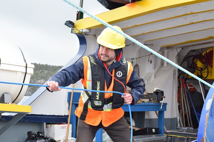
Last summer, he completed an internship with Amundsen Science.
“It was great to be part of so many different science projects and to see all these different fields of science coming together on one platform.”
Among the projects he assisted: using seafloor mapping technology to hunt for glacier scour marks on the seabed and providing a bathymetric chart of the outflow points for icebergs off Greenland for researchers tracking icebergs.
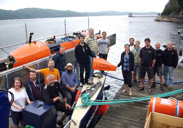
He also completed a training course at the Bornö Marine Research Station in Sweden to learn survey planning and the operation of an autonomous underwater vehicle (AUV) known as the Kongsberg HUGIN.
“This technology is becoming more and more mainstream in the field of ocean mapping,” he said. “Ocean mapping is growing and the advances in technology are happening really fast.

Ocean mapping expedition
During the summer of 2018, Mr. Amirault was the only Canadian student to participate in a multi-national mission on board the U.S. research vessel Okeanos Explorer operated by the National Oceanic and Atmospheric Administration.
He spent 20 days mapping the seabed in deep waters southeast of Bermuda as part of an international effort to map the entire Atlantic seafloor. These maps are important in the study of deepwater habitats, sea life and environmental changes, as well as in site selection for offshore platforms, cables, wind turbines and mineral extraction.
As a watchstander, he monitored incoming data as the ship’s sonar technology mapped the seafloor, examined and cleaned the survey data, and ensured data accuracy by regularly deploying sensors to measure water temperature and depth.
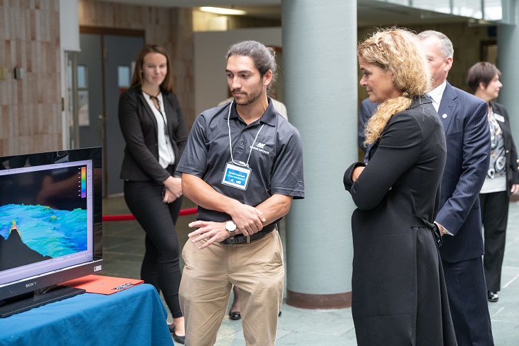
He also was one of seven MI students who showcased their field work and research to Governor-General Julie Payette who visited Newfoundland and Labrador in September 2018. During her tour of the MI campus, Mr. Amirault provided an overview of the Okeanos Explorer expedition.
Valuable learning experiences
At the beginning of one recent academic year, he was asked to give a presentation to new ocean mapping students – providing insights on what they could expect during their first year.
“I explained that the first year is never going to be the perfect year you were expecting because it focuses on fundamentals. You don’t get into the bread and butter of the program until second semester or even your second year in some cases. After that, it gets so much better and you start finding what you’re really interested in.
“The technical sessions and the work terms are the best parts – it’s hands-on learning. What I did in my technical sessions is what I’ll be doing full-time now.”

He also recalls a summer job at MI where he spent much of his time at a desk working on presentations.
“The work wasn’t exactly what I wanted to do in the future, but it was in the field I really wanted to excel in, which was the Arctic. In the end, that position gave me a huge advantage when I applied for this job I have now.”
Sometimes, he says, it’s important to take any opportunity when it comes along.
“You might not get that perfect job the first time, but everything’s a learning experience.”